1990s
The question
What if pixels could show people tomorrow's weather over their own city - not merely describe it?

Pixels with purpose, ahead of their time.
We were using pixels to show what it would look like tomorrow.
ScapeWare3D began in the 1990s with a deceptively simple question: could pixels turn a weather forecast into a place you could enter?
The answer became a real-time visual forecast engine - a navigable world built pixel by pixel from terrain data, satellite and aerial imagery, 3D cityscapes, true sunlight, atmospheric effects, and multiple levels of volumetric fractal clouds.
1990s
What if pixels could show people tomorrow's weather over their own city - not merely describe it?
1999
A real-time OpenGL environment brought terrain, imagery, buildings, sunlight, and layered volumetric clouds into one navigable world of pixels.
2001
A provisional patent was filed, and pixels from high-resolution aerial imagery began appearing inside television news mapping across the country.
Today
That same instinct - turning pixels into useful visual understanding - continues through PixelWorld.tv and the Satellite Imagery Network.
U.S. PATENT 7,250,945 B1
Long before real-time 3D became ordinary, ScapeWare3D rendered fractal textures pixel by pixel into dimensional cloudlets, then arranged those cloudlets into believable weather volumes.
"Assembly of Volumetric 3D Fractal Cloud"
Original patent drawing by Thomas S. Scaman · FIG. 8
Explore the complete patent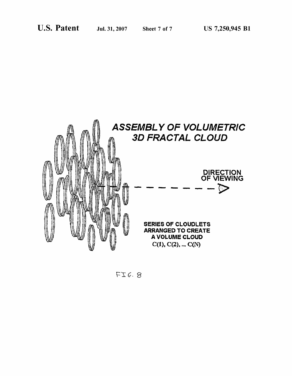
Through early partnerships with AirPhotoUSA and Curious Maps, ScapeWare3D spearheaded the adoption of pixels from high-resolution aerial and satellite imagery by television stations around the world.
Patent: proof of invention. Broadcast archive: proof the pixels reached television.
ScapeWare3D is the corporate origin story behind a continuing pursuit: combining imagery, technology, and storytelling with pixels to help people understand the world more clearly.
Creative technology + storytelling
Strategic creative work that turns pixels, emotion, and emerging technology into unforgettable visual stories.
Visit PixelWorld.tvCommercial earth imagery
A connected path to Earth-observation pixels through imagery access, subscriptions, search, archive research, licensing, and professional project support.
Explore the networkHistorical archives and early pixels, broadcast technology, media, licensing, partnership, or simply a connection to the ScapeWare3D story—send us a note.